Classroom Atlas, European Borders in 1962

ImageToStl.com_merged-document.jpg

Dublin Core

Title

Classroom Atlas, European Borders in 1962

Subject

History, Geography, Education

Description

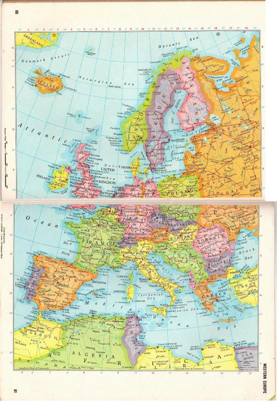
The projected Mercator Map shows European Borders in 1962. In the still image you can see Germany's Iron Curtain and how it was split by the Cold War. As depicted in the image, the Soviet Union still controlled the territories of the Baltic States, Ukraine, and other Eastern Bloc nations. Also displayed are old the states of Czechoslovakia, and Yugoslavia that still reign in 1962.

Physical Dimensions: 14.25 inches x 10 inches

Source

From the Collection of Professor Lydia E. Ferguson

Publisher

Rand McNally

Date

1963, Fourth Edition

Contributor

Mullett, Jack

Rights

This material is subject to copyright law and is made available for private study, scholarship, and research purposes only.

Format

Book of Maps

Language

English

Type

Still Image

Citation

“Classroom Atlas, European Borders in 1962,” Aegis Digital Museum, accessed June 6, 2025, https://aegisdigitalmuseum.kennesaw.edu/items/show/70.